News:

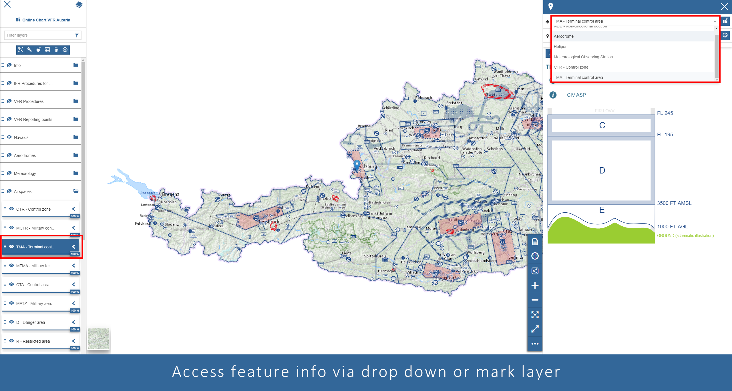
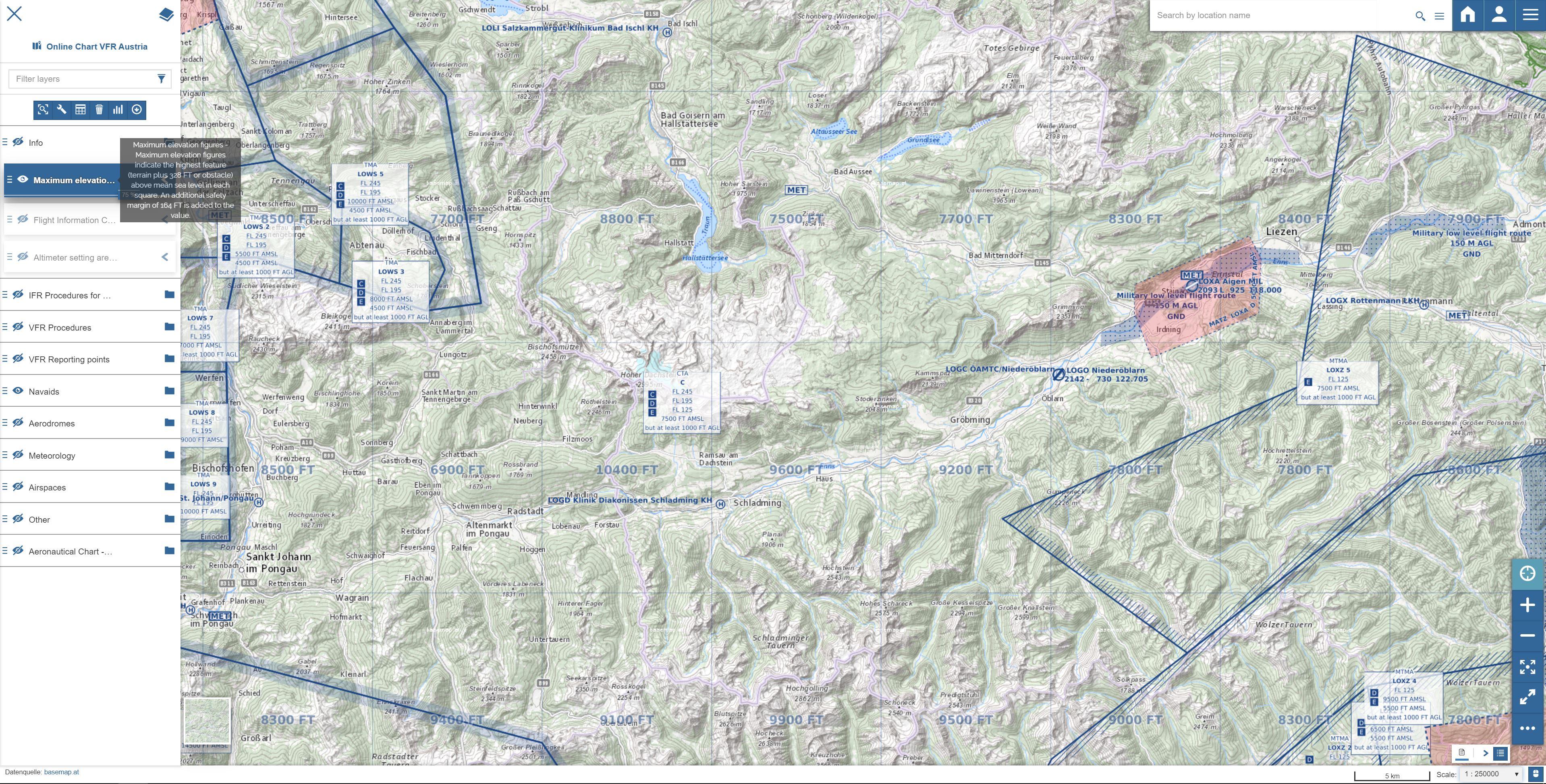
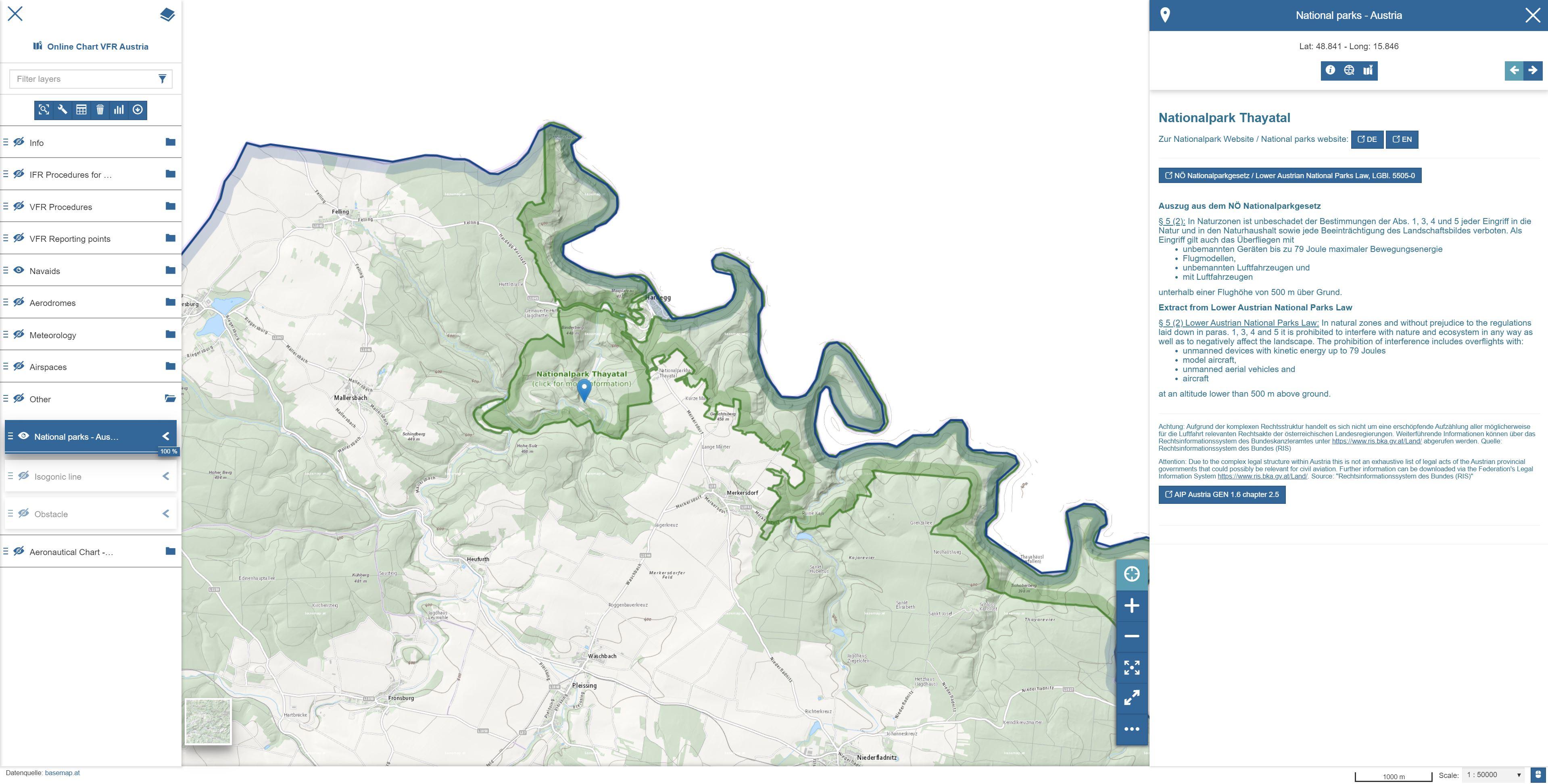
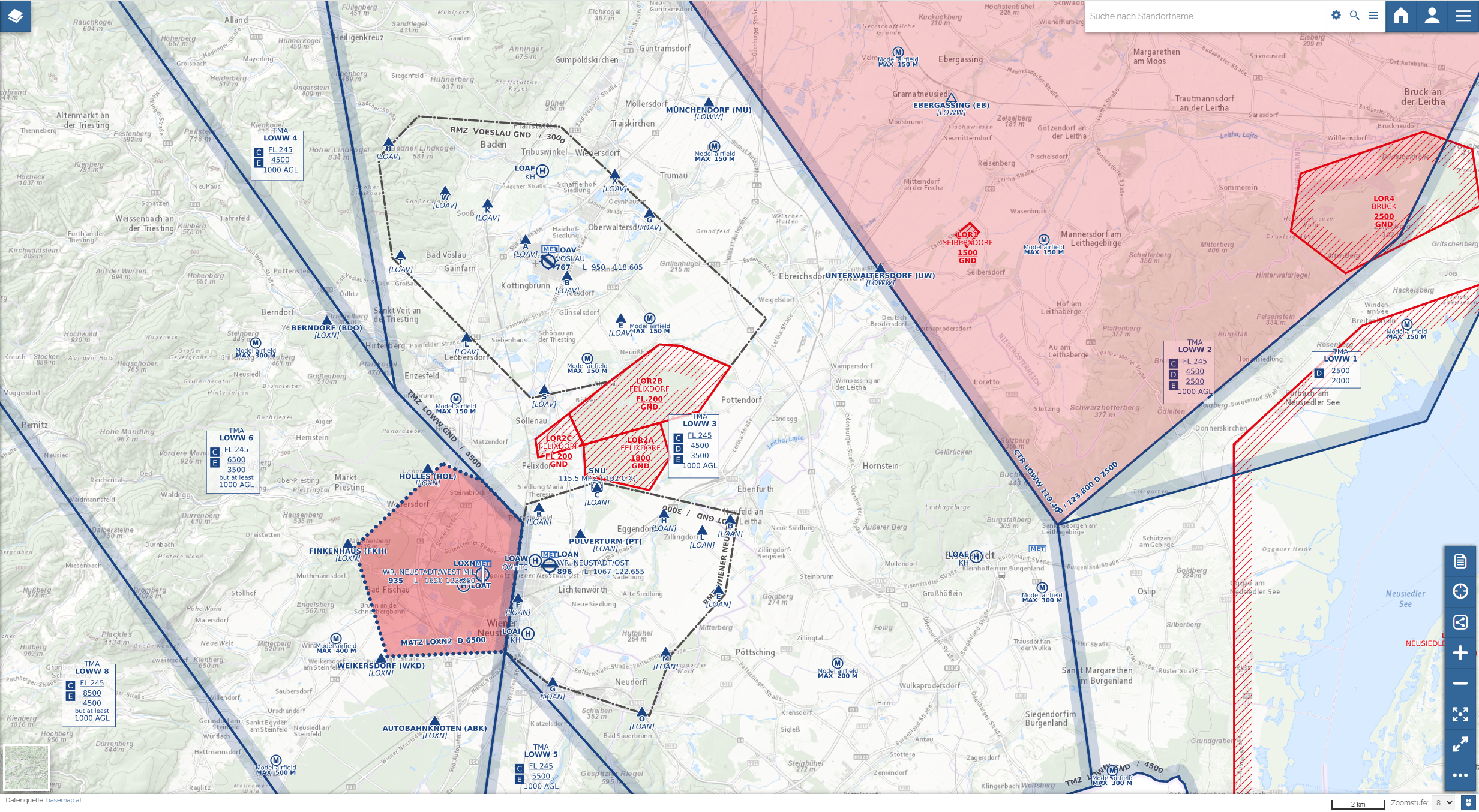
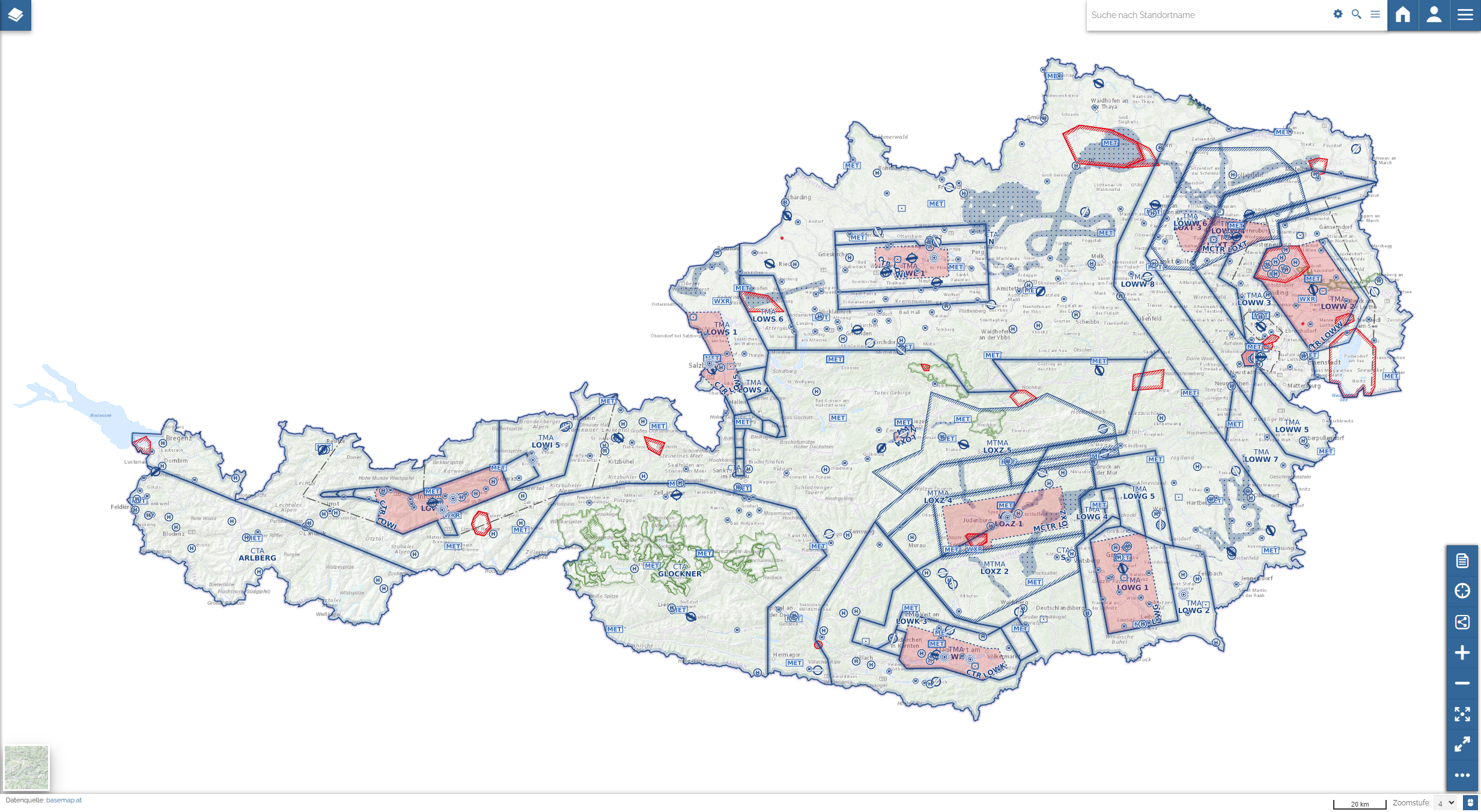
Graphical styles of some layers in chart view of "Online Chart VFR Austria" and "Online Chart IFR Austria" have been adapted in order to ensure a clearer presentation of all features. This includes, among others, new presentation of Airspaces boxes (e.g. TMA, CTA) and new label positions for e.g. Aerodromes and Heliports.

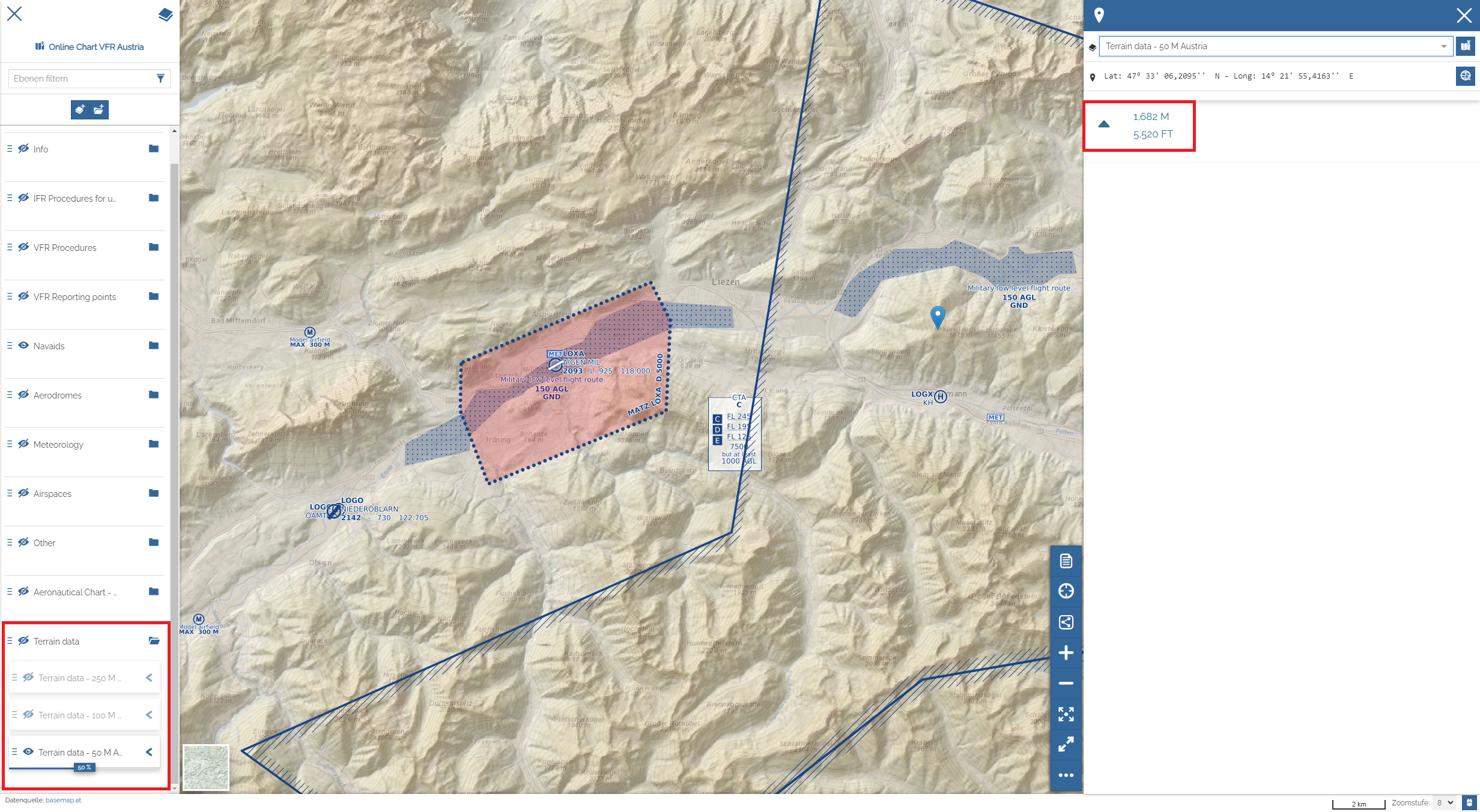
Digital Terrain Models (DTM) with a resolution of 50 M and 100 M have been added. By clicking on the relevant position in the map, the height is displayed in the infobox on the right side of the map.

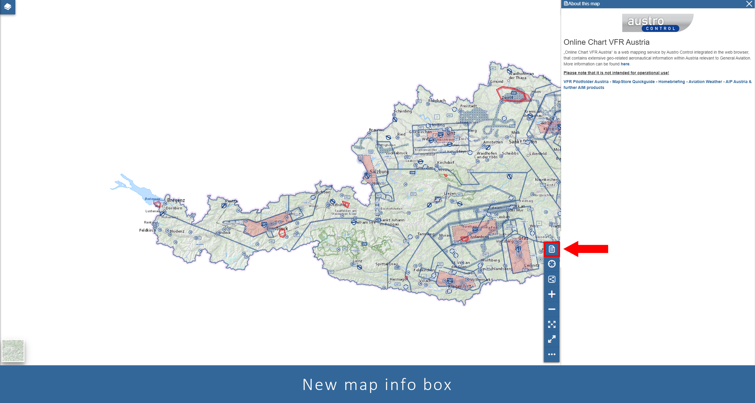
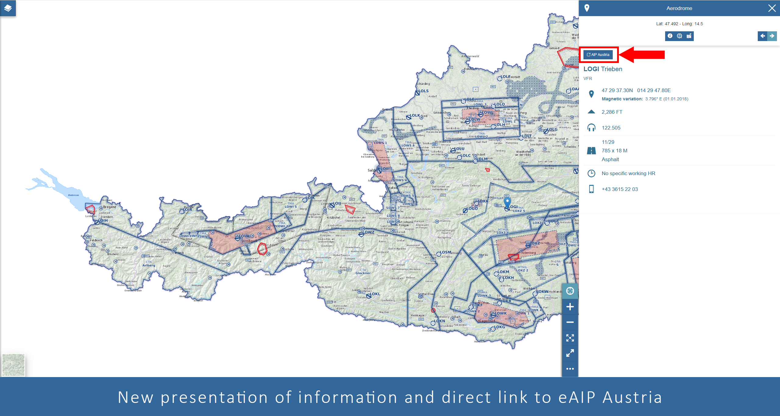
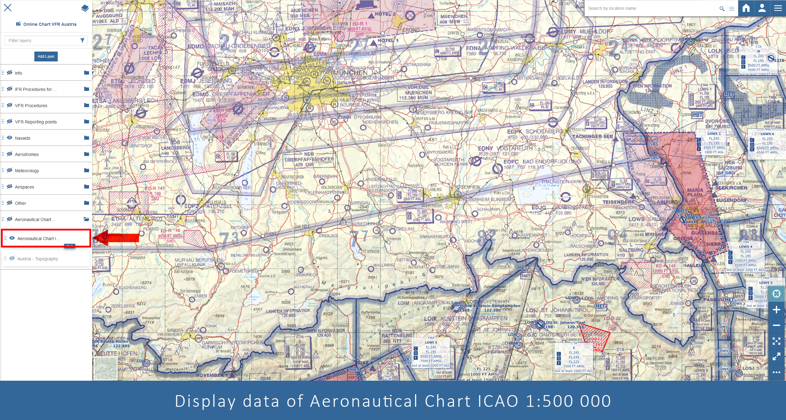
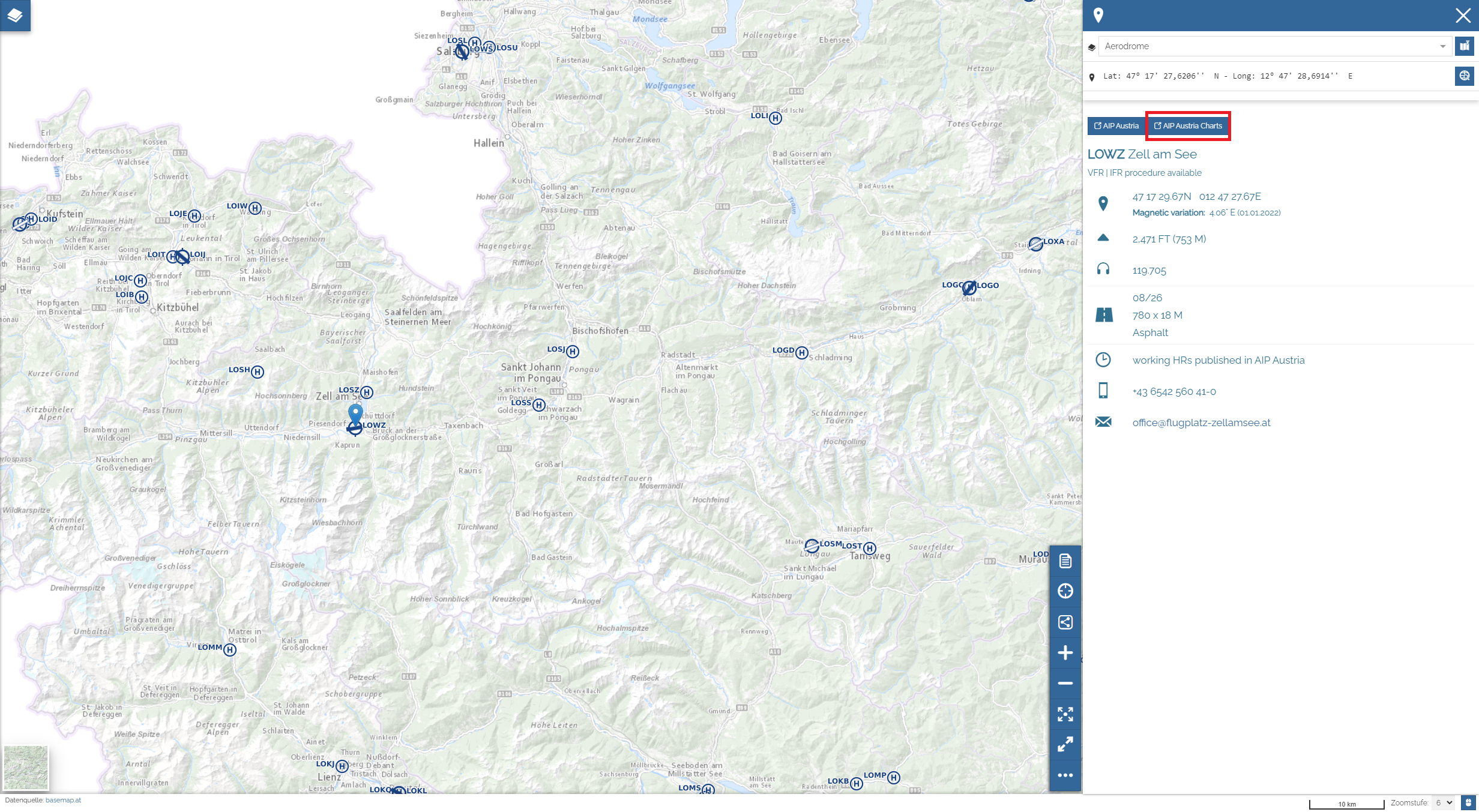
A link to all charts in AIP Austria has been added to all effected aerodromes and heliports in the info box on the right side of the map.

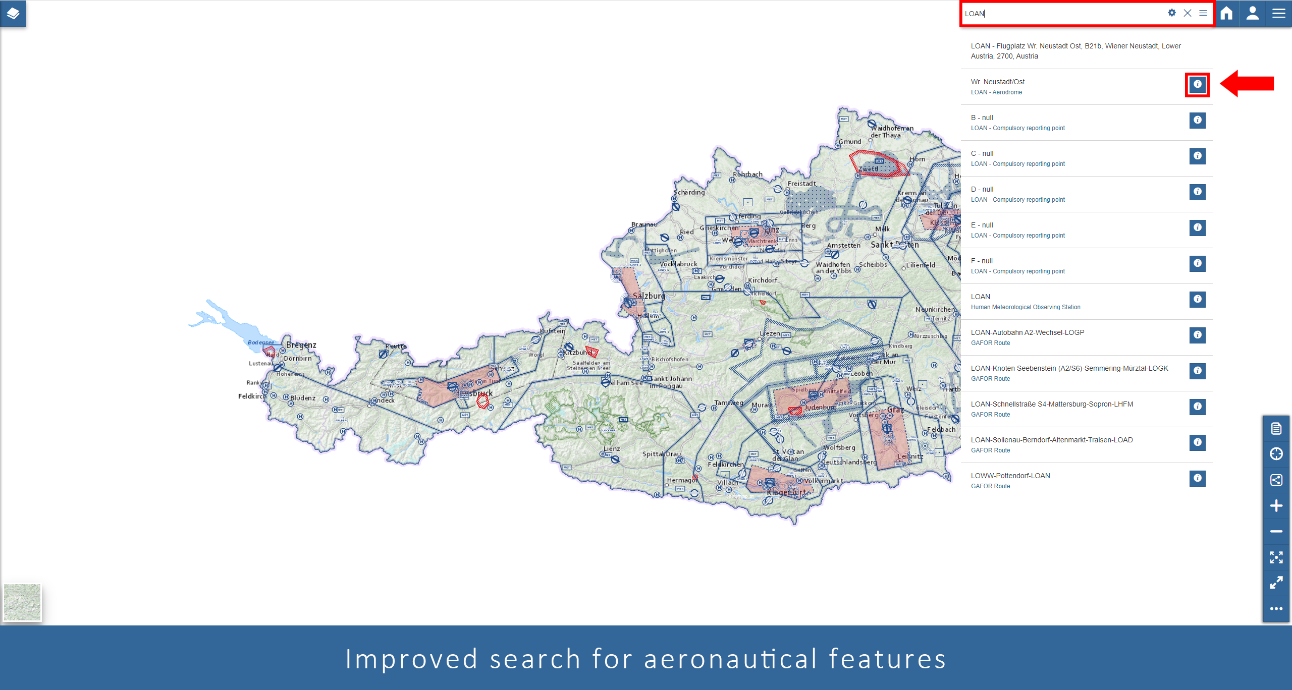
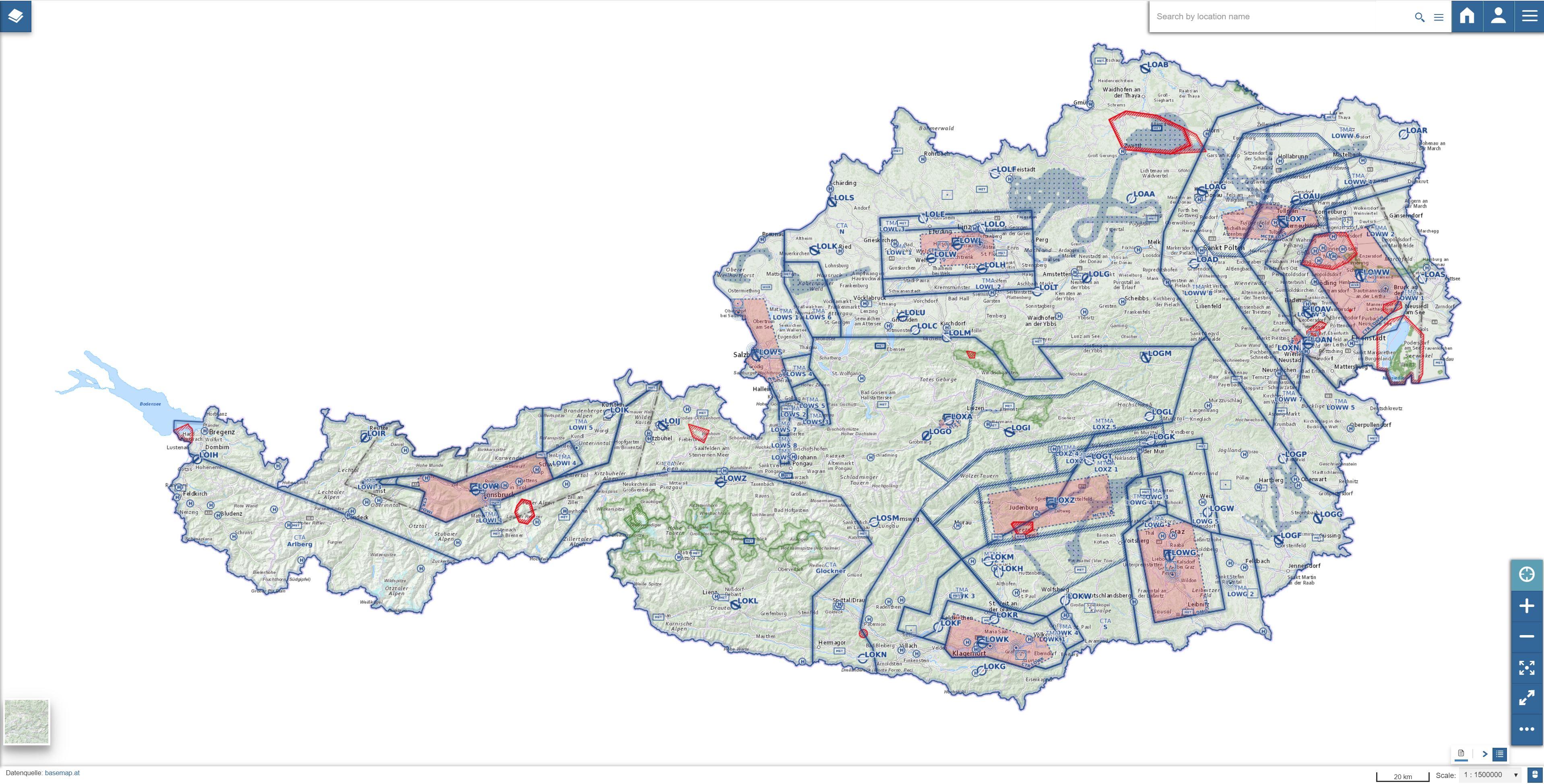
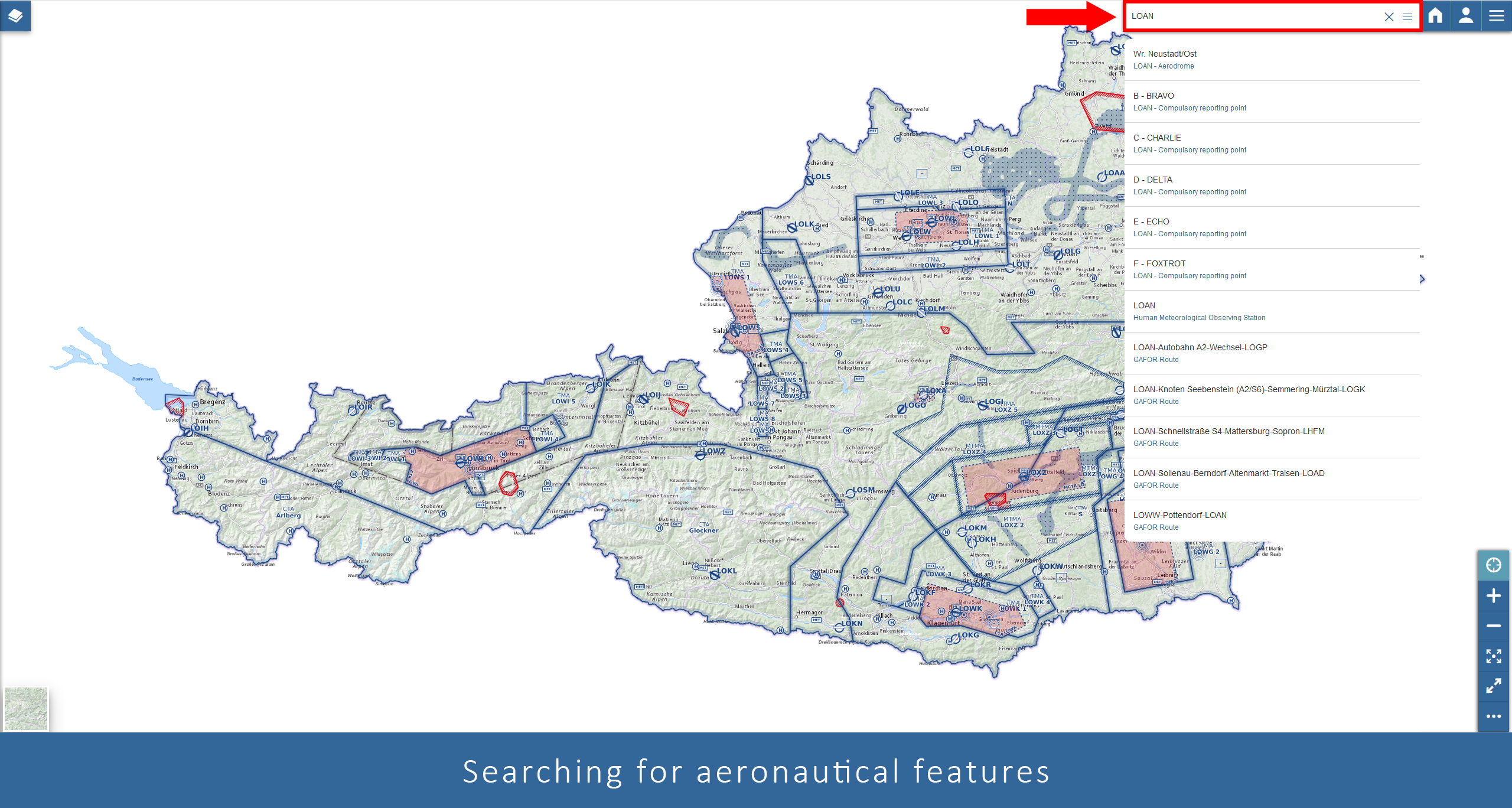
Layers „Compulsory VFR Reporting point“ (VFR_REPP_NC) and „On request VFR Reporting point“ (VFR_REPP_C) have been merged into one layer "VFR Reporting point" (VFR_REPP) and replaced in "Online Chart VFR Austria". All 3 layers will continue to be accessible through ACG web services.

Layer „Model aerodrome“ has been renamed to „Model airfield - increased UAS operation above 120 M” . The layer only shows those model airfields, where increased UAS operations above 120M AGL have to be expected within the surrounding area. Model airfields will automatically be displayed when initially loading the chart.

Austro Control MapStore has evolved!

And we would like to share the news with you ...


A short info video will be available at the Austro Control Season Opener.

Searching aeronautical features has been improved:

You can now directly open a feature's info window by clicking on the i-sign in the search results.

Features that are not visible in the map when searching for them will be automatically displayed after selecting the search result.

Accessing information for a specific feature has become easier as you can access the desired information via a drop down list in the info window.

Additionally it is possible to request only a single feature's info when clicking on the map by marking the specific layer in the table of content

Creating annotations and measurements has been redesigned.

It is now possible to measure length and true bearing (0-360°) for several segments. Furthermore it is possible to store an measurement as annotation and edit it again.

Additionally it has become easier to draw annotation objects on the map.

Further improvements:

  • You can now share a map by a specific coordinate or extent when using the share function.
  • The new map info box provides information about the map content and some helpfull links.
  • It is now possible to print all background maps including basemap.at (the official Austrian OGD basemap).

New data available for Online Chart VFR Austria


Maximum elevation figures, as currently already displayed in the Aeronautical Chart - ICAO 1:500.000.
Maximum elevation figures indicate the highest feature (terrain plus 328 FT or obstacle) above mean sea level in each square. An additional safety margin of 164 FT is added to the value.

National parks including links to and information about the respective provincial government laws in the info box.
Please note: Collection of information about laws is not fully completed yet. Therefore the information will be continuously amended in collaboration with the national parks administration.

Austro Control MapStore has evolved!

And we would like to share the news with you ...


You can access our online charts on maps.austrocontrol.at now!

You can now search for aeronautical features by entering their name in the search bar on the top right corner.

The info box on the right side offers a direct link to the relevant AIP chapter for objects selected in the map.

New data has been added! IFR procedures for uncontrolled aerodromes (incl. COPTER procedures), MET Stations and GAFOR routes are available now.

Aeronautical Coordinates can be additionally displayed for example in the search bar or the info box.

In order to display data of neighbouring states, make the data layer for our Aeronautical Chart - ICAO 1:500 000 visible.